This research is being conducted at the Turkey Point Flux Station. It is comprised of an age-sequence pine (Pinus strobus L.) forests (planted in 1939, 1974 and 2002) and a deciduous (established in 1930s) in southern Ontario, Canada. Turkey Point Flux Station is part of the North American Carbon Program (NACP) and global Fluxnet. Measurements of energy, water vapour and carbon dioxide (CO2) fluxes using eddy covariance (EC) technique and meteorological and soil variables are being continuously made since summer 2002, at three conifer sites and since January 2012 at deciduous sites. All four EC systems are closed-path systems comprising Li-7000/Li-7200 gas analyzers and CSAT3 sonic anemometers. All four sites have trailer/wooden huts to house computers, A/C power and internet connections for daily data downloads. 36-m, 26-m, 20-m and 14-m high walk-up scaffolding towers are used mount instruments at deciduous and three conifer sites, respectively.
See more details of our sites here:
Turkey Point Flux Station research sites are located north of Lake Erie in southern Ontario, Canada. They are known as CA-TP1, CA-TP2, CA-TP3, CA-TP4 and CA-TPD sites. All five Turkey Point Flux Station sites are part of Global Fluxnet (http://fluxnet.ornl.gov/) and Ameriflux (http://ameriflux.lbl.gov/) Networks. They were part of the Canadian Carbon Program (CPP)/Fluxnet-Canada Research Network (FCRN).
See more details of our sites at following websites.
CA-TP1: ON-Turkey Point 2002 Plantation White Pine
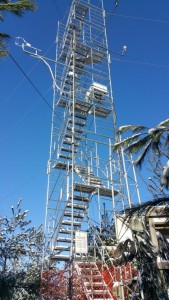
Plantation was established in 2002 on a former sandy agricultural field, which was abandoned three years prior to planting. Site is solely populated by a white pine species, with the understory supporting sparse collections of bryophytes and grasses. Big Creek is within close proximity to the site, where surface water level in the creek is more than 5–6 m below the elevation of the adjacent forest. The climate in the region is warm humid continental with a 30-year (1980–2010) mean annual temperature of 8.0 °C and mean annual precipitation of 1036 mm, with approximately 13% falls as snow, based on data records from the Environment and Climate Change Canada weather station at Delhi, Ontario, about 19 to 22 km north-northwest of our sites.
CA-TP2: ON-Turkey Point 1989 Plantation White Pine Site
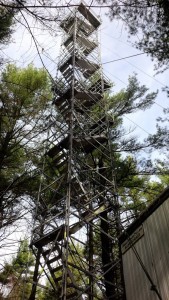
ON-TP2 (also known as ON-TP89) is a young planted white pine (Pinus strobusL.) forest of the Turkey Point Flux Station. It was planted in 1989 (ON-TP89) on sandy agricultural land. Meteorological and flux data collection was started in summer 1989. The data documented here includes carbon, water and energy fluxes and meteorological and soil measurements.
CA-TP3: ON-Turkey Point 1974 Plantation White Pine Site
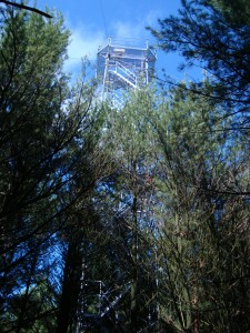
TP3 (also known as TP74) is a monoculture, primarily of eastern white pine (Pinus strobus L.), although 5% of the tree species are Jack pine (Pinus banksiana) and 1% are oak. TPD is far more diverse, with the predominate tree species including white oak (Quercus alba), sugar and red maple (Acer saccharum, A. rubarum), American beech (Facus grandifolia), red oak (Q. veluntia, Q. rubra), and white ash (Fraxinus Americana). TP74 soil is 98% sand, 1% silt, and ><1% clay.
CA-TP4: ON-Turkey Point 1939 White Pine Site
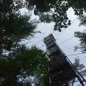
The evergreen needleleaf conifer forest, LAO referred to as Turkey Point 39, was planted in 1939 on cleared oak-savanna lands. The dominant tree species in this approximately 80-year-old stand are eastern white pine and balsam fir (Abies balsamifera L. Mill), making up 82 % and 11 % of the total tree population, respectively. The remaining 7 % of trees are typical native eastern North American forest species, which includes white oak, black oak, red maple, wild black cherry (Prunus serotina Ehrh.), and white birch (Betula papyrifera). The understory consists of young white pines, oak, balsam fir, and black cherry trees, as well as other ground vegetation, including bracken fern (Pteridium aquilinum), blackberry (Rubus spp.), poison ivy (Rhus radicans), moss (Polytrichum spp.), and Canada mayflower. The conifer forest has also been managed on two occasions. A thinning was performed in 1983 in which 4044 m3 of wood was removed from 38.6 ha land area (Ontario Ministry of Natural Resources and Forestry records). In the early winter of 2012, the stand was again thinned by harvesting one-third of the trees (2308 m3), leading to a reduction in stand density (Table 1).
CA-TPD: ON-Turkey Point Mature Deciduous Site
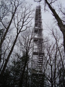
The forest is approximately 90 years old. Naturally regenerated on sandy terrain and abandoned agricultural land. Predominantly hardwood species with a few scattered conifers. Site has been managed (thinned) in the past. It has a high biodiversity with 573 tree and plant species, 102 bird species, 23 mamal species and 22 reptile and amphibian species (SWALSREP Report, 1999). The dominant tree species is white oak (Quercus alba), with other scattered broadleaf Carolinian species including sugar and red maple (Acer saccharum, A. rubrum), American beech (Fagus grandifolia), black and red oak (Q. velutina, Q. rubra) and white ash (Fraxinus americana) . There are also scattered conifers, mostly white and red pine (Pinus strobes, P. resinosa), comprising about 5% of the trees. Average tree height is 25.7 m with a stand density of 504 ± 18 trees per hectare. Average tree diameter at breast height is 22.3 cm and basal area is 0.06 m2 or approximately 29 square meters per hectare.
